The Redlands Area Historical Society is pleased to announce the online publication of its Redlands Historical Timeline with Story Maps and Photos. The timeline was developed through extensive research by local historian Tom Atchley putting together a listing of dates from 1820 to the present outlining significant events in Redlands history.
The Timeline utilizes the ESRI Story Map platform which allows for the integration of text, photos and maps. The Timeline has a comprehensive collection of photos that illustrate who or what was involved. Additionally the Timeline features a series of maps that further illustrate where the historical event occurred. The map series include Sanborn Fire Insurance maps, aerial photos, and other maps found in the ESRI World Atlas collection.
Viewers can search decade by decade or by significant word search. All of the 350+ Historical Society’s Heritage Awards homes are also displayed and linked to their reference pages on the www.rahs.org website.
The timeline format is made possible by the Society’s use of the ESRI non-profit subscription of the ESRI’s Geographical System software and content found in the archives of the A.K. Smiley Public Library Heritage Room, and other online resources.
Click here to find the Redlands Historical Timeline.
Click here to view a demonstration video.

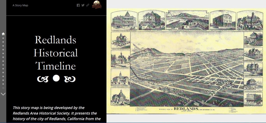
Timeline introduction with historic birdseye image.

Timeline by decade with historic sites highlighted.
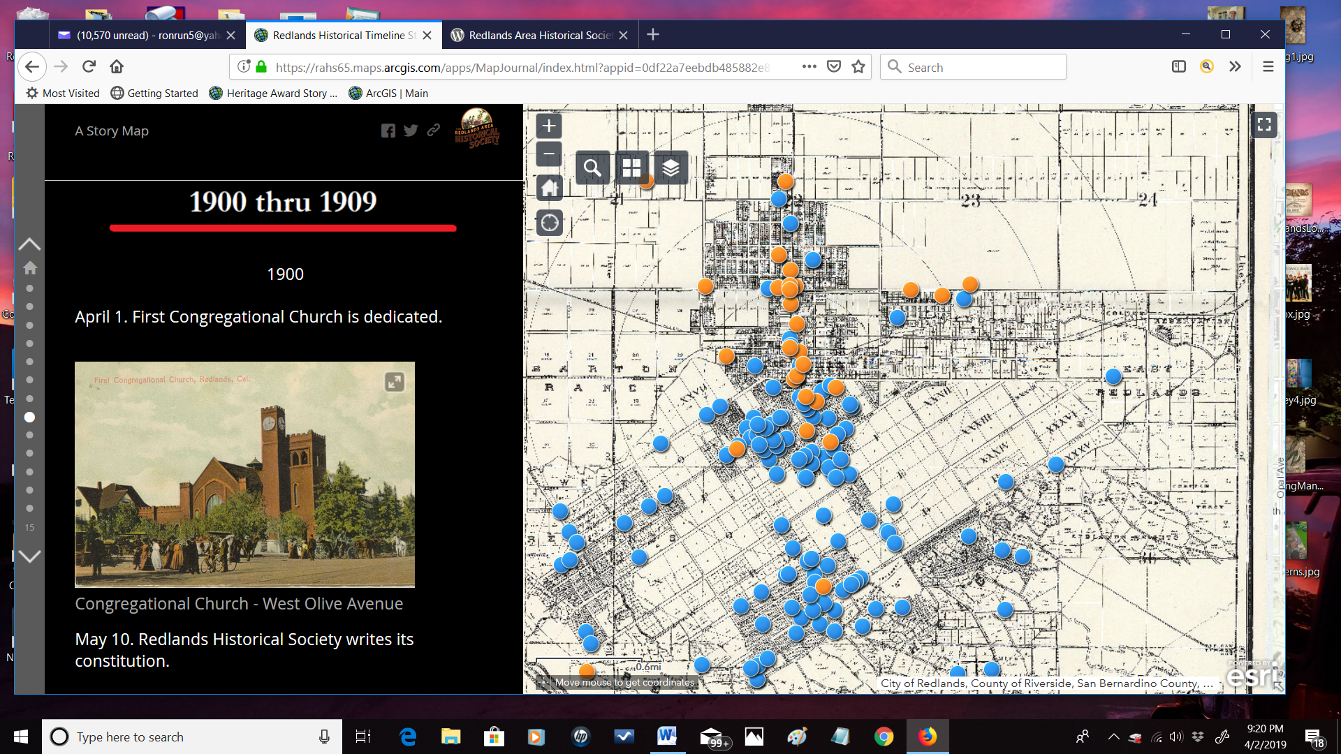
Historic postcard images in timeline. Heritage Homes shown in blue dots.

Early 1900 map and postcard image.

Timeline with Sanborn Fire Insurance Map.
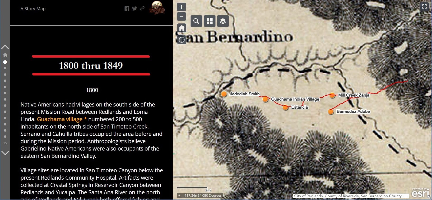
Early territorial map image.
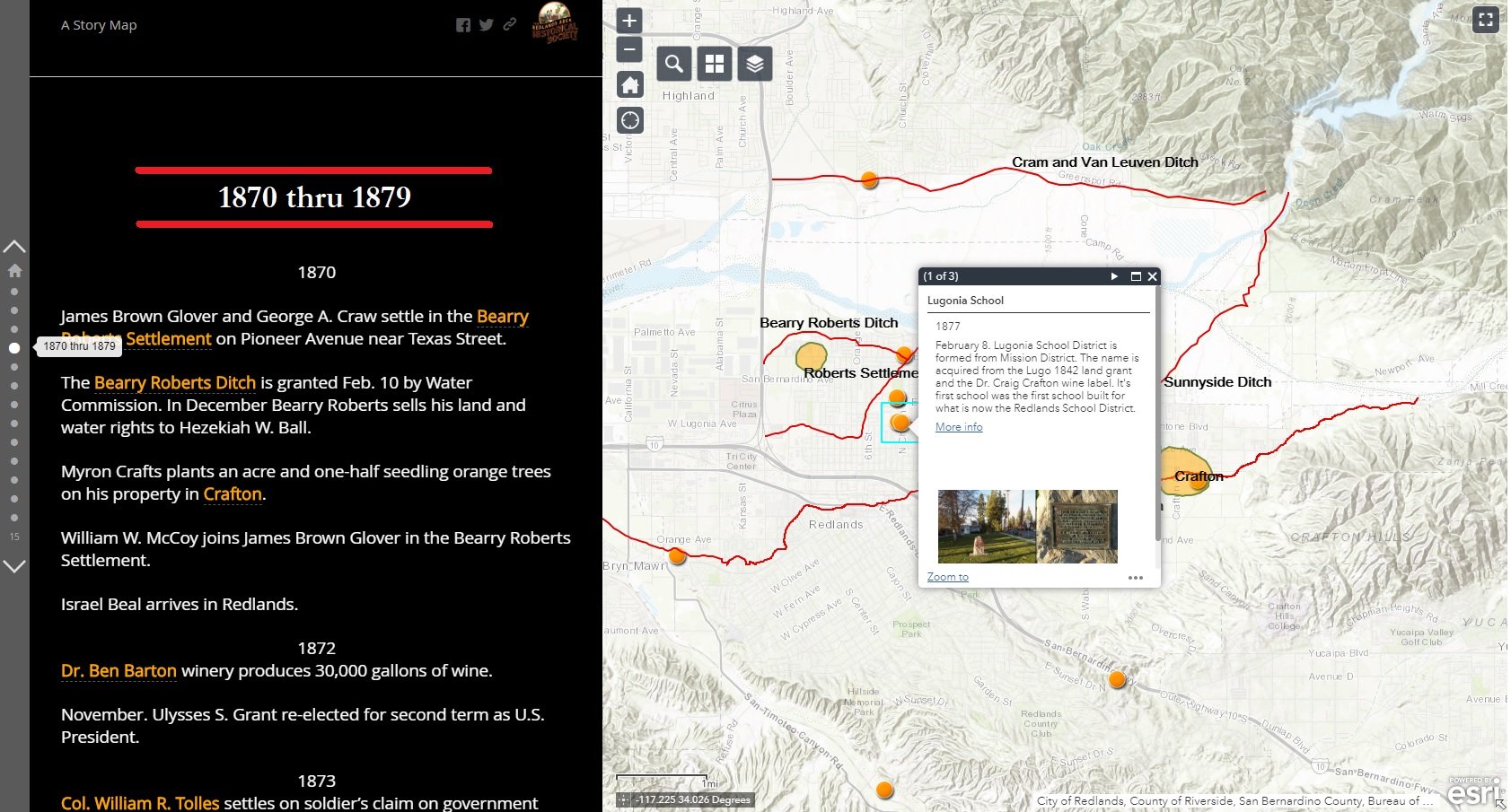
Pop-up reference to historic photos and reference sources.

Pop-up reference shown on close up Sanborn Fire Insurance map.
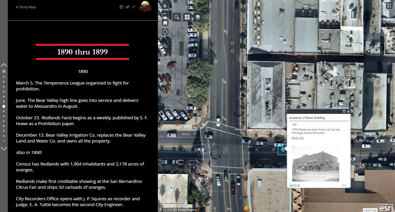
Pop-up reference shown on current day aerial photo.